


Illustrating Vision: The East Mulberry Plan
A capstone project that explores the integration of urban design and planning strategies in an industrial, underdeveloped area of Fort Collins called the East Mulberry Corridor. The area faces impending mass development as the city starts to guide growth to the area, and historically has dealt with flooding and a lack of safe pedestrian connections. Strategies to combat gentrification, honor industrial character, and rebuild infrastructure are explored, and recommendations are provided that are specific to the unique geography and character of the area, including the use of design overlays and guidelines, strategic infill projects, unique recreation and commercial opportunities, enhanced multimodal infrastructure, and drought-resistant green infrastructure that reduces flooding.
-

View the Poster
PDF (8 MB)
-

View the Report
PDF (15 MB)
Selected Graphic Samples


Flooding and Natural Features Map
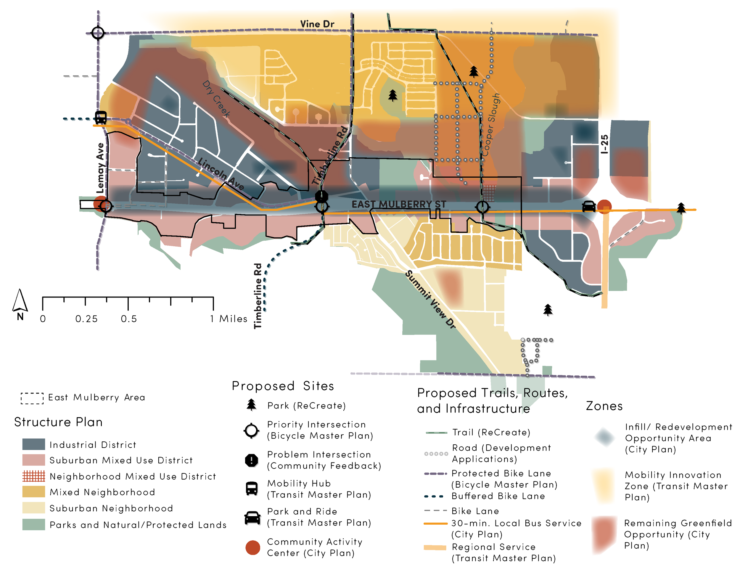
Existing Plan Guidance Map
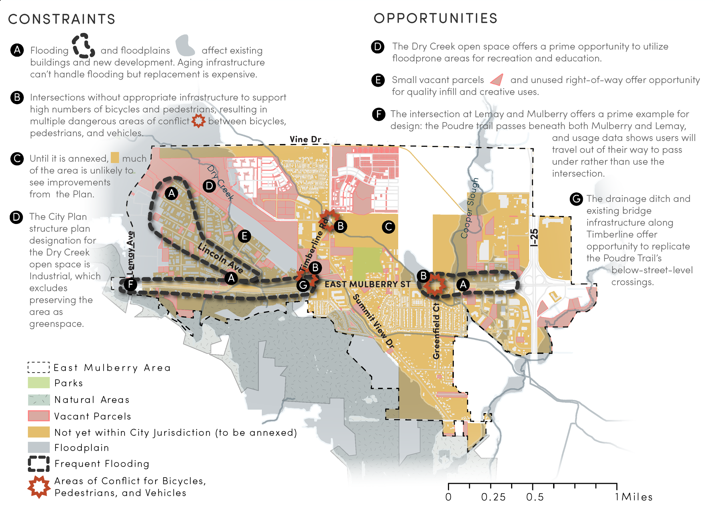
Constraints and Opportunities Map
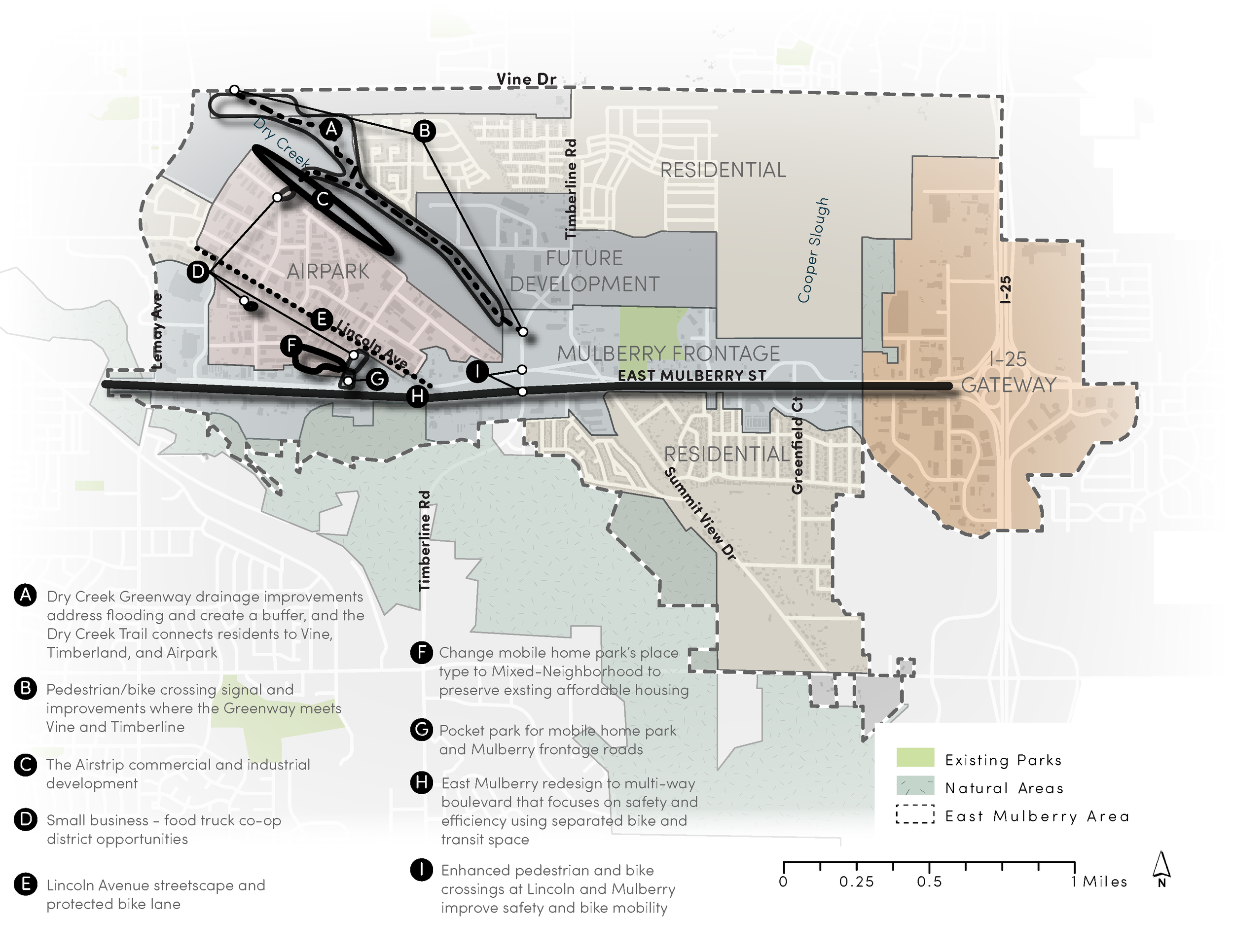
Recommendations Map

